GPR SYSTEM SPECIALISTS
Ground Penetrating Radar and Concrete Scanning
OUR SERVICES
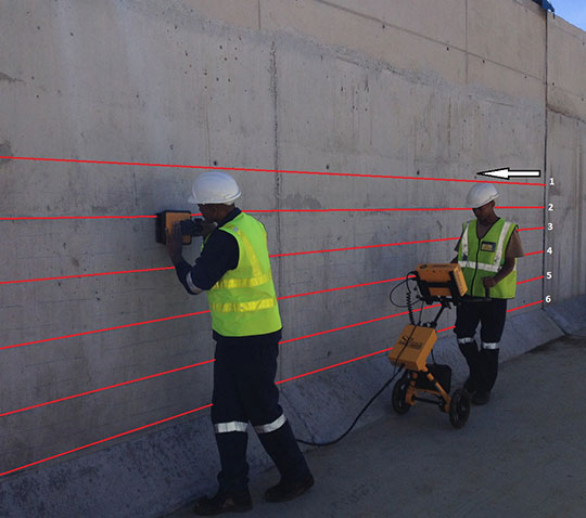
GPR Concrete Scanning
We employ expertly trained analysts that use state-of-the-art GPR (Ground Penetrating Radar) equipment to find common embedded objects and other subsurface hazards that are hidden in the concrete.
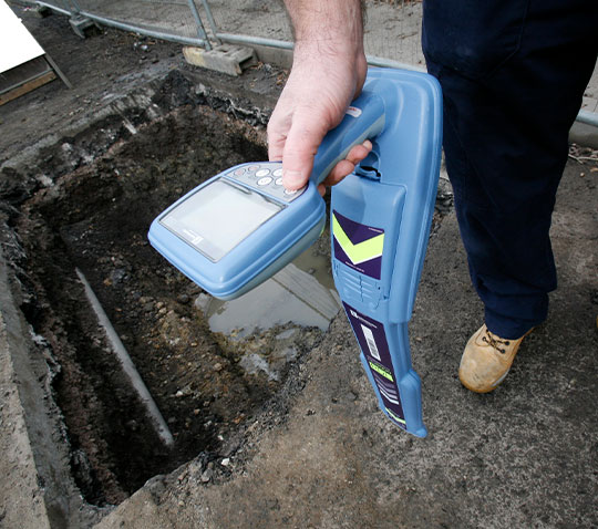
GPR Public Utility Scanning
Striking an underground utility can result in great costs. Repairing a utility line can be expensive, not to mention that you and your community would lose the utility service itself. Most importantly, striking a subsurface object can cause serious injuries to you or the workers on the site.
GPR Private Utility Services
So you’re about to dig or excavate on your property? Removing a tree? Or maybe you’re installing a fence? It is always a wise idea to locate underground utilities before performing any type of digging or excavating on your property. This is where a private locator, like Structure Scan would step in and complete private utility locating.
WHAT DO WE SCAN FOR?
- Pipes and conduits
- Post-tension cables
- Utilities and live wires
- Rebar and rebar patterns
- Voids within the concrete
- Structural integrity of the concrete
BENEFITS
Our skilled analysts can also detect voids within or underneath concrete slabs. With that being said, concrete scanning is generally a complementary service to concrete cutting, coring or grinding. Our services can be pivotal in your construction projects when it comes to cost reduction and damage prevention. Scan before you cut so that you won’t have to encounter financial loss.
OUR WORK
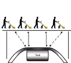
An illustration of a technician easily detecting the depth and position of an underground storage tank using the US RADAR SEEKER 2 GPR System.
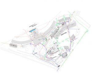
Example of an Autocad site layout showing all of the detected utility services overlaid on the surveyor drawing with GPS coordinates
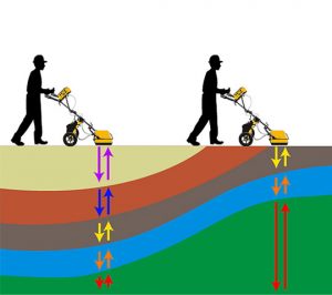
An illustration of a technician detecting he different underground soil layers using the US RADAR SEEKER 2 GPR System.
ABOUT US
Structure Scan offers concrete and ultra sonic thickness scanning.
Making use of the latest aerial inspection technologies we have made significant advancements in the way engineering assessments are undertaken. Gone are the days of rope access methods for inspections. We can prove huge cost savings, zero Health and Safety risks, zero downtime and fast delivery of actionable information. We provide inspection solutions in the following fields: Solar, Telecoms, Power, Oil, Gas, Dams, Bridges, Facades, Silos, Waterproofing etc. If you need to map out subsurface terrains for a number of application, Structure Scan can provide a quality service to you.
We have a wealth of experience in the industry and conduct our services for a number of different applications.
- Detect underground pipes or conduits without having to dig below the surface.
- Delineation of underground wires, cables, sewers and storm water drains.
- Locate underground manholes or water boxes.
- Detect underground voices or underground cavities.
- Determine slab, asphalt layer or wall thickness.
- Locate underground objects such as buried drums, landfill or rubble limits.
- Determine the source of an underground leak.
- Concrete testing and scanning for reinforcing.
- Help locate underground projects.
- Determine concrete slab thickness as well as rebar depth and spacing.
- Concrete slab analysis.
Results can be produced by the following methods:
- On Site Mark Out
- Autocad and Revit Drawings
- Google Earth Overlay
- GPS Coordinates List
OUR CLIENTS
